Pine Meadow Ranch Home Owners Association
  • Home
    • About the Ranch
    • Maps
    • Utah Code Title 57 Chapter 8A Community Act >
      • Rental Restrictions Part 2 Section 209
    • Summit County Ordinances >
      • Dark Sky Ordinance: Title 11 Eastern Summit County
      • Dog Leash Ordinance: Title 5 Public Safety
      • Noise Ordinance Title 5 Public Safety
    • FAQ
    • BLOG/Forum
    • Gallery
  • Events and News
    • Roadwork Updates >
      • August 1
      • Tollgate ~August 15
      • September 5th-Arapaho
    • Noxious Weed Control
    • Survey Results
  • Building & Construction
    • Construction on the Ranch
    • Construction Documents
    • Solar Panels
  • HOA Meetings
  • HOA Info
    • Important Documents
    • Snow Plowing
    • Winter Driving
  • Fire & Safety
    • Fire Safety Committee Updates
    • Wild Fire & Disaster prep
    • Evacuation Plan
    • Evacuation Map
    • Fire Regulations
    • Fire Station
  • Contact Us
    • Communication
    • Just Ask Mike
    • Local Businesses
    • Newsletter Subscriptions

Maps and Directions:


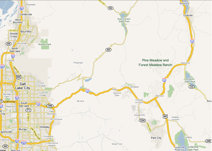
Driving Directions From Airport:
  1. Upon leaving the SLC Airport Exit, head east on Interstate 80 for 4.4 miles.
  2. Merge onto I-15 South / I-80 east heading southbound for 2.5 miles.
  3. Continue on I-80 Eastbound for 28 miles.
  4. Take the Tollgate / Promontory Exit 150 proceed up Tollgate Canyon Road 

Gravel Pit |Winter Parking

Picture

Clink on the link below of the map that you're interested in:


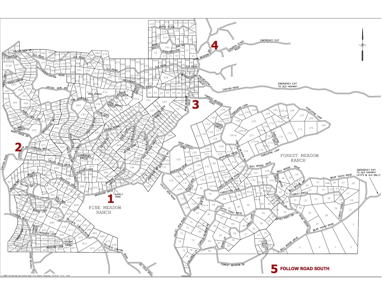
Overall Map of the Ranch: 
Road and Lot map for Pine Meadow and Forest Meadow Ranch (pdf) 

Pine Meadow Ranch Air Ambulance Landing Zone Maps:
Five Landing Zones for Life Flight and Air-Med in Pine & Forest Meadow   Ranches. (jpg)

Latitude and Longitude coordinates of the LZ's with written descriptions (pdf)

3 Mile Canyon Landfill:
Here's a map to the convenient landfill which should be used for anything other than household trash.

Winter Plow Map:
   Plow Map (Privately plowed areas are subject to change) 
 
Voting District Map:
Map of the seven voting districts by lot. (pdf)

Interactive Summit County Parcel Viewer Map:
Plat maps of Pine Meadow and Forest Meadow Ranch 
(Use Caps Lock when searching)


Plat Maps of the Pine Meadow & Forest Meadow subdivisions:
These are large pdf files from the County that show all of the lots on the Ranch. Remember that the Ranch roads were not always cut accurately, but are now legal right-of-ways (see Rules and Regs 4.1). Use these plat maps as a guide.You should always have a certified survey done of your land for accuracy.

   Plat maps of Forest Meadow Ranch (12.3 MB pdf)

   Plat maps of Pine Meadow Ranch (26 MB pdf)

1999-2000 Winter Aerial:
  Forest Meadow Map (182 MB)
  Pine Meadow Map (132 MB)
Note: Some files require Adobe Acrobat to view. Click here to download Adobe Acrobat Reader.

HOME  |  EVENTS AND NEWS |  HOA INFO |  GALLERY  
|   BUILDING & CONSTRUCTION  |  FIRE REGULATIONS 
SNOW PLOWING  |  HOA MEETINGS  |  CONTACT US | MAPS|  ABOUT |  ADMIN ​